Storms have largely settled down across the Kansas City area after a severe thunderstorm watch covered parts of northeast Kansas and northwest Missouri overnight Wednesday. The watch expired at 2 a.m. Wednesday, but forecasters still said scattered showers and storms could linger into early morning, mainly north and northeast of the metro.
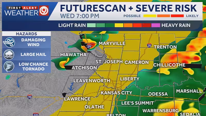
Conditions are expected to stay relatively quiet through midday Wednesday before another round of storms develops later in the afternoon. The next system could bring a renewed risk for severe weather between about 3 p.m. and 9 p.m. Wednesday, with the timing of the threat coming earlier in the evening than previous storms.


That shift matters because it shortens the window between the quiet stretch in the morning and the next round of potentially stronger weather later in the day. The pattern is a short-term one for the Kansas City area, but it gives commuters, schools and anyone planning to be outside a much tighter runway before conditions can turn again.
Even after the overnight watch ended, the setup did not fully clear out. The lingering showers early Wednesday morning and the expected redevelopment later in the day show that the atmosphere remains unsettled, and the day’s calmer hours are only temporary.
The question now is whether the afternoon round stays limited or turns severe during that 3 p.m. to 9 p.m. window. For Kansas City, the answer is not to count on the morning calm lasting into the evening.