A rainy start to Tuesday gave way to lingering showers in North Texas, and residents were told to get ready for a stormy weekend as the forecast shifted quickly from wet to unsettled.
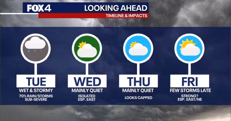
A disturbance brought widespread showers and isolated thunderstorms to the region Tuesday morning, with frequent lightning and heavy rain expected. Severe weather was not anticipated on Tuesday, but the highest rain chances of the week were locked in for the day and afternoon highs were expected to reach the low to mid-60s.


Moisture was expected to keep rain chances in the forecast for Wednesday, particularly east of DFW, before a warming trend begins mid-week and temperatures climb into the mid-70s. The workweek is expected to stay mostly quiet after that, with temperatures gradually rising and a dryline developing that could trigger storms each afternoon and evening through the weekend.
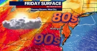
That is where the picture turns less certain. An unsettled and stormy pattern is expected to return to North Texas on the weekend, with strong thunderstorms possible across parts of the Metroplex as early as Friday. Severe weather is possible during the afternoon and evening hours both Saturday and Sunday, and the potential for severe weather is increasing even as the details on timing, coverage and intensity remain unclear.
The forecast from the National Weather Service and FOX 4 forecasters points to a changing weather pattern across North Texas rather than one isolated storm, which is why people with outdoor plans were told to stay weather-aware and keep checking for updates as the weekend approaches. For now, the answer to the week’s big weather question is straightforward: after a damp midweek pause, Fort Worth weather is headed back toward a more active and potentially dangerous stretch by Friday night into Sunday.