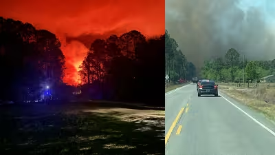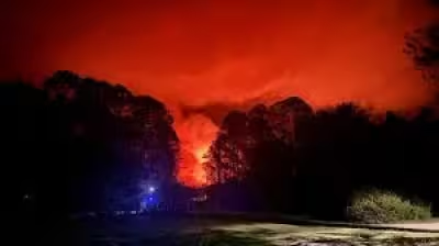
A Red Flag Warning is in effect Tuesday across a large part of the area generally along and west of the St. Johns River as dry ground, low humidity and gusty wind combine to drive up the fire danger. Temperatures are expected to climb into the 80s this afternoon, with winds gusting up to 20 mph at times.
The warning comes after months of worsening drought that has left most of the area in extreme drought and expanded exceptional drought conditions to cover more of the region. Little rainfall is expected over the next seven days, though there is about a 30% chance of rain later this weekend as an approaching front moves through.
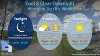
The numbers tell the story. Afternoon highs are forecast near 81 in one spot, 82 in another, 89 farther south and as high as 90 in the warmest locations, with overnight lows around 55, 58, 63 and 64. That combination of heat, dry fuels and wind gives fires a better chance to start and spread quickly, which is why the fire weather threat is high today.
The tension is that the outlook offers little relief before the weekend, and even that change is uncertain. A front may bring some rain later, but the chance is only around 30%, leaving the region exposed through much of the week. Residents are being urged to follow any burn ban in place and treat the warning as a sign that a small spark could become a fast-moving fire.
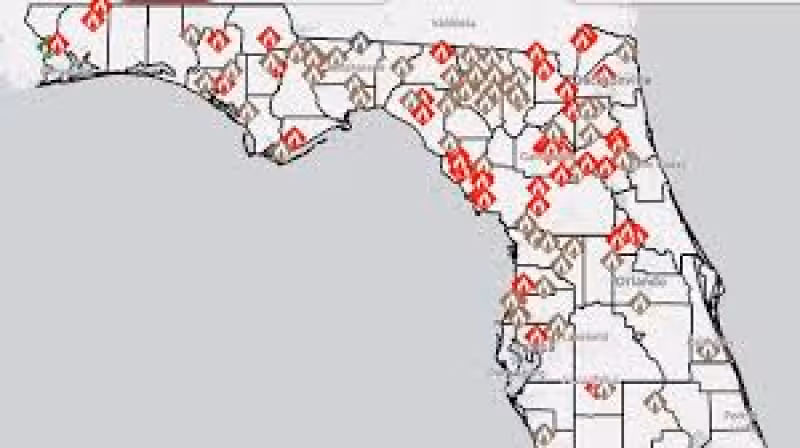
For anyone checking a Florida wildfire map Tuesday, the headline is simple: the danger is broad, the drought is deep and the window for meaningful rain remains narrow.