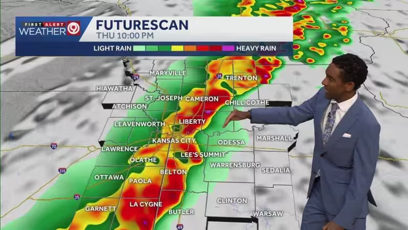
A First Warn Weather Day was in effect Thursday as a line of rain and storms moved toward the region, with the National Weather Service issuing two Tornado Watches and warning that some storms could turn strong to severe. Strong winds were the main threat, but large hail up to apple size, winds over 80 mph and a couple tornadoes were also possible.
One Tornado Watch covered Holt, Nodaway, Andrew and Atchison counties in Missouri until 7 p.m. The second covered Franklin, Anderson, Douglas and Jefferson counties until 9 p.m. The metro and points to the south and east were not in a watch at the time of the report, though forecasters were monitoring storm development to the west. A Level 2 out of 5 severe weather risk covered much of the region, while western parts of Atchison, Franklin and Douglas counties in Kansas were upgraded to Level 3 out of 5.
The setup carried a low flood threat, with most areas expected to pick up 1 inch or less of rain and isolated spots getting up to 2 inches. Isolated areas could still see extra-heavy rain, but the bigger concern Thursday remained the chance for stronger storms to break out before the main line arrived. Isolated supercells were possible from now until 7 p.m., with the highest risk for those stronger storms in the Level 3 zone west of Kansas City.


That line was expected to become more widespread from 6 p.m. to 2 a.m., moving from northwest Missouri southeast across the area. The main severe threat in the evening and overnight line was damaging wind, though isolated spin-up tornadoes and hail were also possible. Storms in the Kansas City metro were expected between 8 p.m. and midnight, and the system was forecast to clear the entire area by 2 a.m. Friday morning.
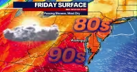
After the rough weather, Friday was expected to turn dry and sunny, with morning temperatures in the low 50s and highs around 73 degrees. The calmer stretch may not last long. Saturday carried a 30% chance of rain and storms in the afternoon to evening for those along and south of I-70, and new data brought a low Level 1 out of 5 severe weather risk to far southeastern counties, where wind and hail were expected to be the main threats. By Sunday, rain was expected to return with a 50% chance and a Level 2 out of 5 severe weather risk, most likely in the evening into Sunday night.
For now, the key question is not whether Thursday had storm potential — it did — but which areas would catch the strongest storms first as the line organizes west of Kansas City before pushing southeast.