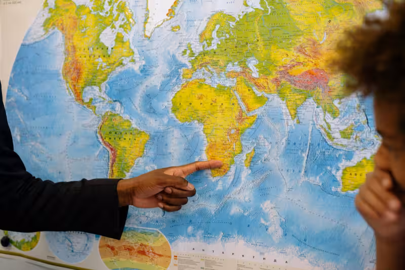
Togo has formally petitioned the United Nations to adopt a world map that reflects Africa’s true land area, putting pressure on international organizations, governments and schools to move away from the Mercator projection. Foreign Minister Robert Dussey said the resolution should be ready for a vote at the UN General Assembly in September 2026.
The push is being led by Togo on behalf of the African Union, which has asked the country to carry the issue onto the global stage after its 55 member states adopted a resolution to stop using the Mercator projection within their own borders. African diplomats are framing the coming vote as a test of whether the world is prepared to back equity and decolonization with a practical change.
Moky Makura, who has criticized the Mercator map’s staying power, called it a long-running misinformation campaign that has diminished Africa’s identity and shaped how people see the continent in media, policy and classrooms. She said accurate representation is about agency, progress and ensuring the world sees Africa as it truly is.


The argument has sharpened because the Mercator projection, created in 1569 for nautical navigation, keeps shapes recognizable but distorts relative size. That distortion makes Greenland and North America appear far larger than they are while Africa looks smaller than its real footprint. Africa spans about 30 million square kilometers and is 14 times the size of Greenland, a scale that supporters of the campaign say is still hidden by the map most people grew up with.
The United Nations already uses different projections, including the Robinson projection, and it does not require member states to use any single world map. That gives Togo’s petition a clear opening, but also exposes the gap between what can be changed inside the UN system and what many schools, governments and publishers around the world continue to print.
The next step is the one African diplomats are counting on: a vote in September 2026. If it succeeds, the campaign would move from a regional correction effort to a global standard, and the map on the wall would finally begin to reflect the continent the way Togo says it should have been shown all along.