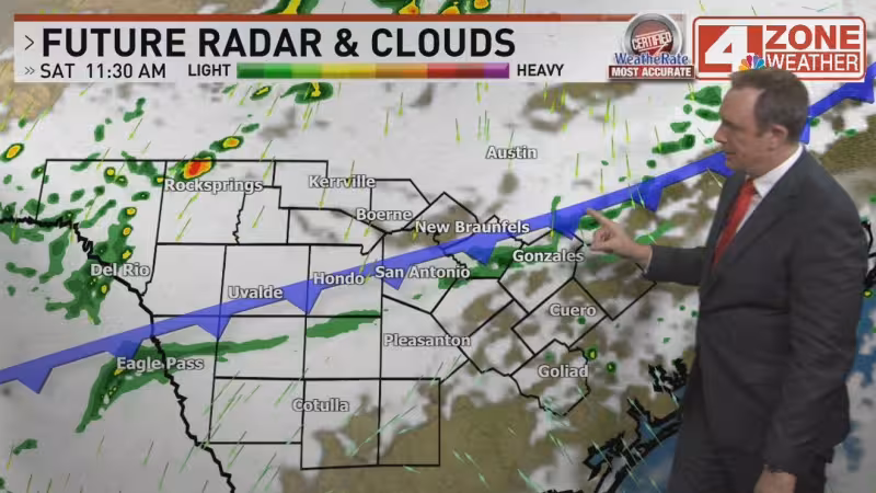
A line of showers and thunderstorms is moving in from the west tonight, bringing a round of rain that will be mostly non severe but could still hit hard in spots with a heavy downpour and pea sized hail. The showers are expected to gradually weaken overnight and clear out for most by morning.
Sunday should bring a calmer break for much of the area, with most of the rain staying well south of San Antonio and temperatures holding in the 60s. Clouds will thicken Sunday night, and a few sprinkles are possible before another round of showers arrives the following day.

That next system comes from an upper-level disturbance and could keep off and on showers in the forecast through the day, with highs struggling to get out of the 50s. The timing may improve a bit for the Texas Cavaliers River Parade, where showers may try to wind down in time for the event.
The weather pattern does not stop there. Temperatures are expected to gradually warm from Tuesday on, and meteorologists will keep a small storm chance on the radar for Battle of Flowers as Fiesta week weather continues to shift across South Texas.
For now, the forecast points to a moving target rather than one isolated storm. San Antonio gets a brief break Sunday, then another cool, damp stretch follows Monday before a slow warmup begins Tuesday.