Scattered rain and thunderstorms are expected to move through central Florida this evening, bringing lightning, gusty winds and even small hail to some neighborhoods before the weather settles down overnight.
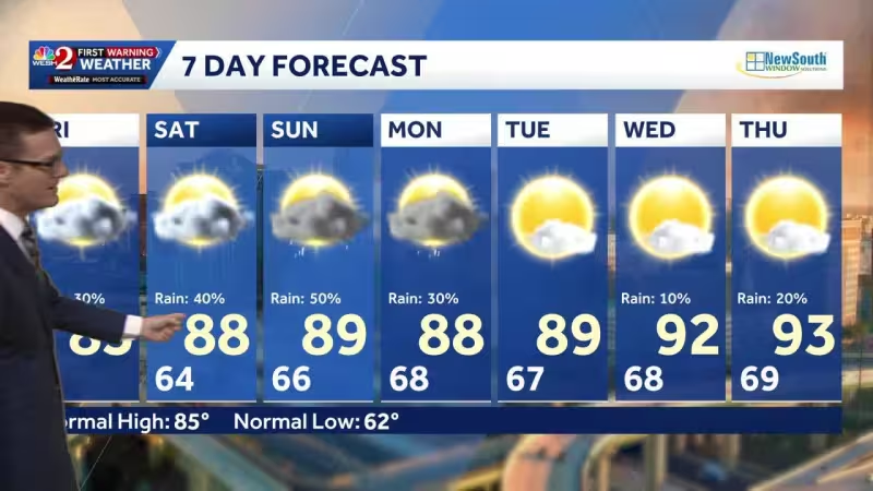
Temperatures are expected to fall into the 60s after sunset, then patchy dense fog may develop by Sunday morning. The day is expected to start warm with scattered clouds, and highs should climb into the mid to upper 80s as rain chances rise to around 30% to 40%.


The setup is being driven by a large area of high pressure over the Atlantic Ocean that is weakening but still parked near Florida. By Sunday afternoon, winds are expected to shift from the southwest to come in from the ocean, and sea breezes on both coasts are expected to meet near the Orlando area later in the day, a boundary that can help trigger storms.
That means the day is not likely to stay dry for long. A few showers and storms are possible on Monday, and after that the weather is expected to turn drier and hotter, with highs in the lower 90s for the rest of the week.
For Orlando, the near-term question is not whether the rain clears completely, but how quickly the atmosphere shifts from scattered storms this evening to fog, then back to the chance for a few more showers before the hotter stretch takes hold.