The Pacific Ocean is flashing signs of a climate shift that could arrive in the months ahead, and international climate centers have now confirmed the El Niño event. Forecasters say the odds are rising that the pattern will take hold, with the NOAA estimating a 61% probability that El Niño will occur and only a 25% chance that it develops into a strong to very strong episode.
Paul Roundy, an atmospheric scientist, said there is a real potential for what could become the most intense El Niño in 140 years. He added that current models point to a moderate to strong event, but they do not yet reach the scale of the benchmark 1997-98 or 2015-16 episodes. For now, the forecast remains shaped by uncertainty, and it will be necessary to wait until June, when models are expected to move beyond the predictability barrier and produce firmer estimates.
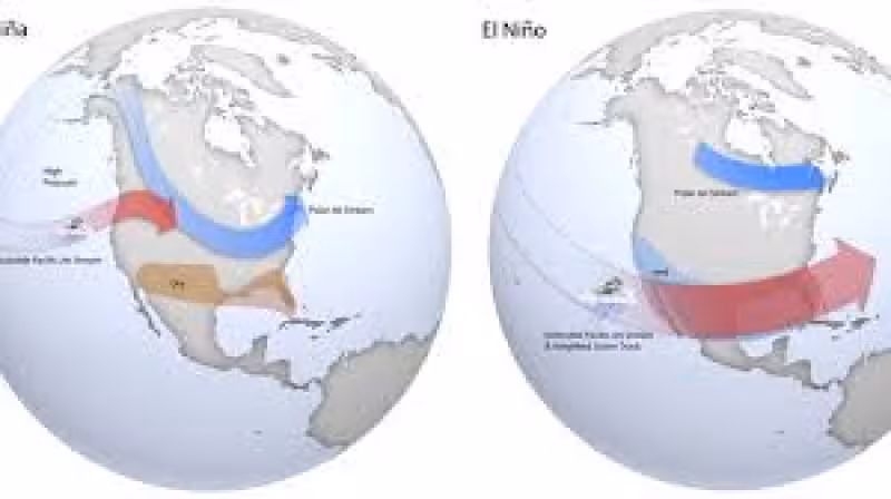
That matters because the next shift in the Pacific could reshape weather far beyond the ocean itself. El Niño weakens the trade winds and pushes large masses of warm water toward the coast of America, altering rainfall and temperatures on a planetary scale. The NOAA says the effects are felt in the Americas, Asia and Europe, and the impact can be immediate for areas already managing dry spells, saturated soils or fragile river systems.

In Argentina, the first signs are already being mapped out by season. Starting in spring 2026, forecasters expect a wetter signal to consolidate in northeastern Argentina, with Misiones potentially seeing precipitation anomalies above 100 mm. By summer 2026-2027, the rainy core is expected to spread across Corrientes, Entre Ríos, Santa Fe and northwest Buenos Aires province, with rainfall excesses of 60 mm or more across the whole period. Those projections line up with the kind of pattern that can overwhelm drainage, and experts say people in vulnerable areas should review or buy drainage pumps to reduce flood risk.
The tension is that the same pattern can help some places and punish others. For agriculture, the extra rain could ease water deficits in some zones while raising the threat of flooding in already saturated Pampas areas. In the Paraná delta wetlands, livestock can face disease, hoof injuries and logistical problems if floods are not managed in time. Heavy rains linked to El Niño also raise the flow of the Paraná, the Uruguay and their tributaries, a combination that has historically driven floods and mass evacuations in the Argentine Litoral, including the multimillion-dollar losses tied to the 1982-83 event.
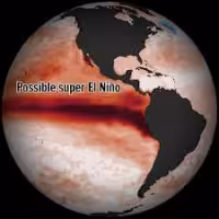
Some media are already calling the expected shift a Súper El Niño, but the current data do not justify that label with certainty. The next real test comes in June, when the models should finally be able to see past the barrier that has limited sharper forecasts. Until then, the Pacific is sending a warning that is broad in effect but still narrow in detail: a stronger wet signal is building, and the people living along the river basins and farm belts of Argentina will be among the first to feel it.
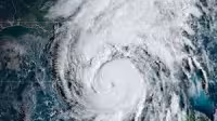
Related forecasts have already suggested a slightly below-average 2026 Atlantic season, and a separate outlook due Thursday is expected to track how the El Niño signal may shape hurricane risk. In another sign of how closely forecasters are watching the Pacific, a rare cyclone cluster near Orlando has also been cited as part of the larger El Niño picture.